

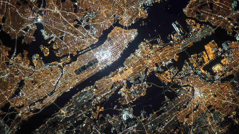
Remote sensing data via satellite cameras provide essential information that can help in monitoring various applications like land cover classification, change detection, and image fusion. Remote sensing can be defined as a critical technology that is used to obtain information related to the earth’s environment and resources. What made satellite imagery data so popular is that they can be accessed easily via mapping applications like Bing Maps and Google Earth. You can easily ‘find your house’; additionally, satellite camera use this technology has also helped guide civil defense people, monitor natural calamities and disasters, and project planning.
Remote sensing satellite camera images and data also include temporal, spatial, and spectral resolutions. Spectral statistics contains elements of remotely sensed image classification. The central aspect that influences the accuracy and precision of the ground object is the spatial resolution. The temporal resolution will generate land cover maps for environmental planning, transportation planning, and land-use change detection.
Does Satellite Camera Provide Accurate And Specific Data?
Yes, satellite camera work to provide specific data, like:
1. Data For Graphical Reference For Engineers And Planners
The amount of details you can see in an orthoimagery is produced via high-resolution satellite imagery, which is of great value. This is because you can see a detailed image of the specific area, along with the surrounding.
Since maps are based on location, they have been designed to provide highly-structured data and provide a complete picture of the area. There are many different applications of remote sensing data and satellite imagery. Today, government officials use these satellite camera view images to help in critical decision-making like police, civil defense operations, and GIS (Geographic Information Systems). Today, satellite imagery data has become very important, and decisions and plans are made based on this data.
2. Extraction Of Mineral Deposits Via Remote Sensing And Spectral Analysis
When it comes to the feasibility stages of mineral exploration, it is crucial to understand and know about the mineral potentialities of the area being considered for mineral extraction. In these cases, the mapping and its integration on a GIS basis via satellite remote sensing can help engineers study and map the zones and save time.
Engineers and scientists can quickly map the availability of the minerals via special indicators with the help of the spectral analysis of the satellite image bands. This will also help them by enabling the geologist to narrow the test drilling, geochemical, and geophysical activities in the high potential zones.
3. Planning For Disaster Mitigation And Recovery
Any natural calamity can have a very devastating result and can also prove to be a challenge when it comes to assessment. However, disaster risk assessment is very important for rescue workers. This information needs to be prepared quickly and then executed with utmost precision and accuracy. With the help of object-based classification via change detection before and after the event, rescue workers may acquire damage assessments and other related data. You can also use satellite tracking camera imagery data for measuring other disaster assessments like measuring shadows from digital surface models and buildings.
4. Agricultural Development
With the increase in the world’s population, there has also been a rise in agricultural production. To do this, you would require proper management of the world’s agricultural resources. You would also need to obtain reliable data on the types of the resources and their location, quantity, and quality.
GIS and satellite imagery will prove to be a significant factor in improving the current systems of generating and acquiring agricultural maps and resource data. Agricultural surveys and mapping are presently being conducted to gather statistics and information on agricultural resources, livestock, rangeland, and crops. The information is essential for implementing various management decisions. This survey is vital for allocating limited resources to different sections of the economy.
5. 3D GIS
3D city models are a digital representation of urban areas that represent landscape elements, infrastructure, vegetation, buildings, sites, and terrain surfaces. This also includes the objects belonging to these urban areas. The components can easily be depicted and represented on the corresponding 2D and 3D spatial data and geo-referenced data.
The 3D models support the management, analysis, exploration, and presentation of tasks in a large number of various application domains. 3D GIS is an effective and instant solution for a remote and more prominent location where a manual survey is almost an impossible task. Different rural and urban planning departments are always looking for 3D GIS satellite camera real time data like sewerage, drainage, etc.
Final Thoughts
Satellite camera image has become an essential tool used by scientists, explorers, and meteorologists in today’s time. In short, they are the eyes in the sky. These images reassure the behavior of the earth and the atmosphere so that you have an accurate, concise, and clear representation of how events are unfolding. Conducting research would become extremely difficult without satellites. Satellite images are capable of showing things that cannot be seen or measured. These images can be seen as the truth. There is no chance for an error. The satellite camera access provides data that can be interpreted first-hand; you will have a decent representation of what is happening worldwide.
What are your thoughts? Leave a comment below!